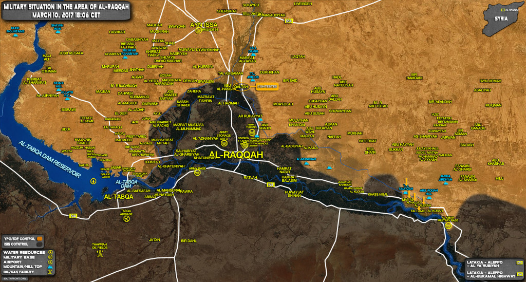
The US-backed Syrian Democratic Forces (SDF), predominantly consisting of the Kurdish People’s Protection Units (YPG), have captured more areas from ISIS east of the terrorist-held city of Raqqah.
The SDF took control of the village of Al-Matab and the Unayzah Hill (Tall Unayzah) located in the province of Deir Ezzor.


very nice map!!!
Now that Mat’ab has been taken by SDF and there is some sort of understanding with SAA, I would like to see SAA advancing across the Euphrates via Mat’ab, through SDF lines and get to Deir Ezzor while pushing Eastward from Palmyra at the same time. This should be considered by the SAA high command. Instead of having risky missions of landing people there, why not drive there? Have to wait and see!
SF Map shows at south-east corner/bottom right a so-called AL-KIBAR MILITARY BASE. As far as I know there is no base at this location, the area has been controlled by ISIS since 2013. Perhaps confused with the alleged “nuclear facility ” bombed by Israelis (Op Orchard) in 2007 ( Blue Building on GoogleEarth) or the dis-used airstrip (1100 meters at 35,74 N 39,83 E) earlier raided/recon in force by US on 06 JAN 2017 ? Either way if mapped deployments are correct, SDF/YPG now control main MSR (N7) on left bank, now just a short distance to cross Euphrates narrows by intact bridge (only 180 meters wide) just 700 meters north of the ancient historic Roman/Byzantine fortress then cut N4.
I believe the airstrip will be improved and used to re-inforce/re-supply/sustain joint US/SDF operations, thus blocking ISIS riverine and road traffic. US already have at least 6 000 combat troops in theater, ready to roll .