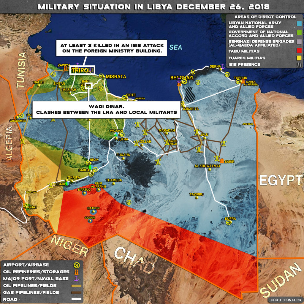
This map provides a general look at the military situation in Libya.
- On December 25, ISIS attacked a foreign ministry building in the city of Tripoli;
- On December 26, clashes were reported between the Libyan National Army and local militants in the area of Wadi Dinar.


Please repeat please will SF correct the blatant errors on this map , the most obvious being :
1. Oil/gas pipeline colors are incorrectly labelled in the legend – dark brown on the map are oil pipelines not gas.
2. Sarir field is wrongly located on the Waha-Dafa oilfields – Sarir and Meslah are further south east where a refinery is incorrectly marked.
3. Areas marked as “direct control” are wildly exaggerated – the blue coloration shows LNA+allies” with contiguous control over most of Libya including Zawia on the coast west of Tripoli which is nonsense.
4. Similarily the areas shown as Tuareg or Tebu controlled are pure fiction – these areas are 99 % empty desert and straight lines on a map are meaningless – at most some local militia may exercise power in small settlements but do not have “direct control” outside their immediate clan/tribal districts.
5. ISIS is shown to control an area SE of Benghazi. Where is the evidence for this purely notional control ?
6. The tag claiming LNA forces operating right up to the Beni Ualid-Misrata highway is wrong. The LNA simply does not operate this far from Benghazi, local clashes by various tribal notional “affiliates” do not mean the LNA has “direct control” here or elsewhere
7. Most of this map appears to be based on incorrect, dubious intelligence or wishful thinking. Please edit to maintain some credibility on SF. Thank you