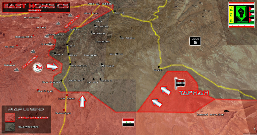
Government forces have recaptured the Tafhah Mountain located in about 20km northwest of the Tiyas Airbase from ISIS terrorists in the province of Homs. The advance was announced by the Syrian Defense Ministry earlier today.
Thus, the Syrian Arab Army (SAA) and the National Defense Forces (NDF) deployed closer to the vilalge of Manukh located along the road heading to the city of al-Salamiyah located northeast of the city of Homs.
With this advance, the SAA and the NDF increase further a pressure on ISIS terrorists south of Jubb al-Jarrah in order to regain the whole ISIS-held area besieged by government forces from northern, southern and western directions.


“Fater”? I think you meant after guys..
Yes, you are right. Thank you for the feedback.
My pleasure! (I was actually thinking of becoming a volunteer-research/proofreading-but so far I could not find the time. Hopefully soon I ‘ll email you guys..)
I heard in an analysis video by Al masdar news that it is very important for SAA to fully retake this area and push eastwards from here towards central Syria in order to mitigate a potential overehelming counterattack of retreating daesh forces from raqqa. If they can do that, they will have nowhere left to run except southeast towards Jordan I think.