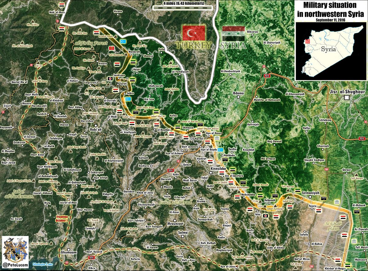
In the northeastern part of Latakia, the Syrian government forces have stormed Kabbani and the nearby areas, including the hilltops of Jabal Hassan Al-Ra’i, Tal Haddadeh and Jabal Tufahiyah that had been controlled by Jabhat Fateh al-Sham (formerly Jabhat Al Nusra) and its allies.
As result of this move, by Sepember 13, the Syrian army and its allies have captured Jabal Hassan Al-Ra’i and Jabal Al-Tufahiyah. However, they have not been able to push terrorists from Kabani. Further attempts to do this are expected in the nearest future.
The advance on Kabbani is a part of the wide-scale offensive of the Syrian Arab Army (SAA), the Desert Hawks Brigade, the Syrian Marines and and Syrian Social Nationalist Party (SSNP) that was launched last Friday.


I don’t know why they put out article after article that lists the name of a village or mountain along with a map that never has that name on it! Or, if it does, the spelling is different so that I do not know Kabbani as it is spelled in the article with anything written on the map! And even if it was on the map, direct us to it! Don’t make me spend forever looking for the name! Let me know it is there and where it is by doing something! Underline, circle, whatever!
Yes. The maps are done by a different person though. Overall Southfront is interesting, but many of the articles don’t bear any insight. Essentially it appears they failed to take Kabbani but captured a few places that are of no relevence, Jabal Hassan Al-Ra’i, Tal Haddadeh and Jabal Tufahiyah appear to all be hill tops. Any pictures of the hill tops? I interpret this as meaning there was some action near Kabbani but as far as intelligent interpretation goes it leads a lot to be desired. Maybe something on the units involved in the assaults, the number of enemy troops, their locations, what the assault was like, trench warfare or simply empty ground? casulties,strategic implications, etc etc.I personally find a huge disjunct between places they mention and what you can find on Google Maps. But then again, theres a lot of disinformation out there. All in all I like Southfront and log in everyday. Its a little more complete the the BBS’s page on the Middle East. I have sets of Times Newspapers from 1830-1900 and the war reporting would have been volumous, American Civil war, Boar war, Crimea and all sorts. It makes compelling reading. Modern media is unfortunatly lacking in most regards.
Hill tops give you visual command , and if backed by larger guns , greater range. A tiny bit of intel , sums it up !
If you pay attention you can understand the general flow of the war, the direction of the offensives etc.
Do you see Sirmaniyah at the bottom right? It is the bigger symbol than the rest. A little to the left of that there is Kobaneh or something. Must be the one the syrians are attacking with different spelling.